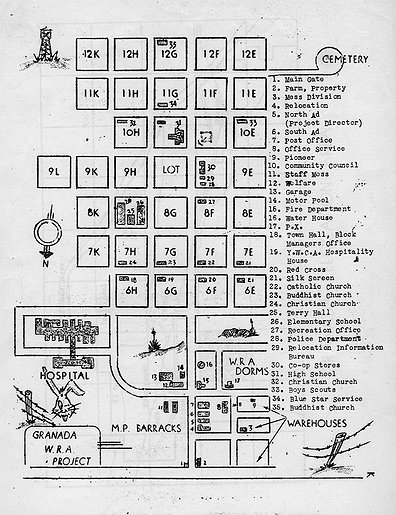
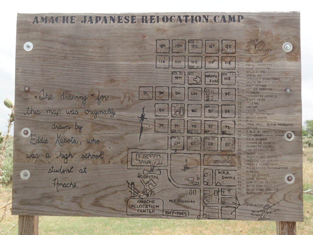
The map below is from the chapter on Amache in the online book Confinement and Ethnicity: An Overview of World War II Japanese American Relocation Sites. You can also visit the interactive Amache Directory Map for a GIS view of the site and to find out who lived in each barrack, based on the 1943 and 1945 directories.